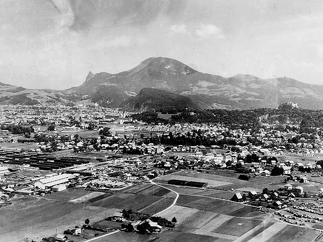
SALZBURG - MAXGLAN - BEITH BIALIK
A panoramic view of Salzburg with Maxglan at center. Just left of center is the Pfarrkirche St. Maximilian in alt Maxglan. There is little trace of the Struberkaserne barracks center left that is the location of the post-war Beith Bialik Displaced Persons Transient Camp run by the UNRRA and the AJDC (American Jewish Joint Distribution Committee). Maxglan was the second largest town in the region before becoming part of Salzburg in 1935 and the fastest growing section of post-war Salzburg. The rock peak at left is Nockstein at 1,042 meters; the large peak at center is Gaisberg at 1,287 meters; just below is Kapuzinerberg at 636 meters. The Hohnsalzberg Fortress is on the hilltop right of center. The small hill below Kapuzinerberg is Monschberg with the Pfarre Mulnn cathedral visible to the left of the hill.
» (click for detail and alternate image) «
photo: dogfacesoldiers collection
surf all sections : Anzio | Rome | Dragoon
Breakout | Montelimar | Vosges | Strasbourg
Colmar Pocket | Rhineland | Germany | Austria
3rd Sig. Photographers :: HOME PAGE :: Dogface Gallery
>