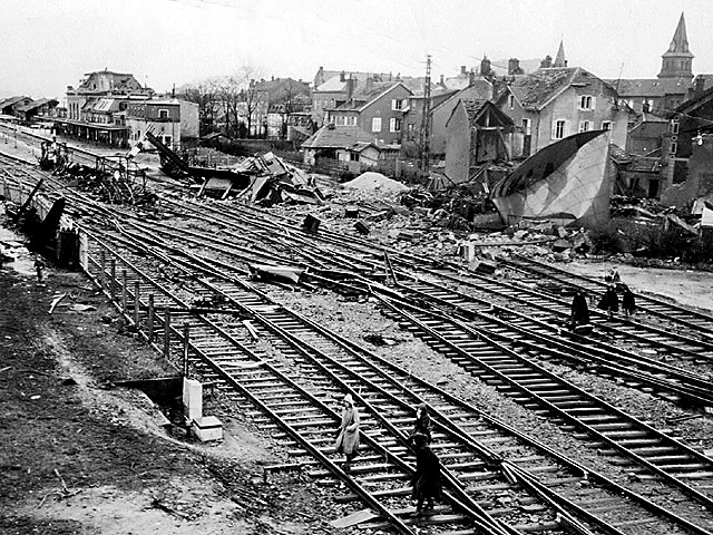
SAINT DIE
A view of the damage to the area around the St. Die train station (upper left), south of the Muerthe River. In the course of battle, St. Die had been shelled, but it was the German fires that destroyed most of town. The spire on the right is the Church of St. Martin the patron saint of people of mixed race, innkeepers, barbers, and public health workers.
location: 48°16'52.3"N 6°57'05.5"E
photo: dogfacesoldiers collection
surf all sections : Anzio | Rome | Dragoon
Breakout | Montelimar | Vosges | Strasbourg
Colmar Pocket | Rhineland | Germany | Austria
3rd Sig. Photographers :: HOME PAGE :: Dogface Gallery